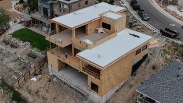
Drone Mapping & Aerial Photography
Detailed aerial maps for property and terrain documentation, plus scenic aerial photography that showcases your location.

Detailed aerial maps for property and terrain documentation, plus scenic aerial photography that showcases your location.

Understand your property with detailed aerial imagery, elevation models, and contour maps. Deliverables are tailored to your project and the software you use.
Detailed overhead imagery that shows buildings, roads, vegetation, and other visible property features.
Elevation models and contour maps that help you visualize slopes and changes in terrain.
Maps, imagery, and data prepared for your CAD or GIS software, with formats tailored to your project.

Explore practice-project examples of orthomosaic imagery, ground elevation models, contour maps, and terrain hillshade.
These maps represent digital deliverables that can support your project in compatible GIS, CAD, and other software. Depending on the deliverable, available formats may include GeoTIFF imagery and elevation rasters, contour files, and PDF maps.
Tell me which software you use so we can discuss suitable file formats for your project.
View four examples from the same practice project: aerial imagery, ground elevations, contours, and terrain relief.

I earned Drone Launch Academy’s Advanced Drone Mapping & Modeling certificate and badge, with additional training in 3D modeling and digital twins, construction and engineering mapping, land-survey mapping workflows, geodesy, and GNSS positioning and survey control.
I have held my FAA Part 107 remote pilot certificate since August 2021.